Gregor Luetzenburg
Gregor Luetzenburg is a Postdoctoral Researcher at the Geological Survey of Denmark and Greenland (GEUS). His primary project involves developing a database of Holocene marine limits and relative sea levels across Greenland. Gregor is also engaged in mapping the extent of the Greenland Ice Sheet and assessing the impacts of climate change on Greenland’s peripheral glaciers. Most recently, he has begun analyzing Holocene relative sea level changes in Southern Greenland using sediment cores from isolation basins. Gregor’s background is in coastal geomorphology, with expertise in coastal cliff erosion, landslides, and the effects of climate change on coastal regions.
Professional Experience & Education
2023 – ongoing Postdoc at the Department of Glaciology and Climate
Geological Survey of Denmark and Greenland (GEUS)
2025 – ongoing Guest Lecturer & External Examiner for the course Climate, Glacier and the Human Impact
DIS Study Abroad in Scandinavia
2023 – 2024 Guest Lecturer at the Sedimentology Field Course
The University Centre in Svalbard (UNIS)
2021 Visiting Researcher
University of North Carolina at Chapel Hill
2019 – 2022 MSCA TALENT Doctoral fellow at the Departement of Geosciences and Natural Resource Management
University of Copenhagen
2017 – 2019 Master of Science in Geography
University of Vienna
2015 – 2019 Research Assistant at the ENGAGE – Geomorphological Systems and Risk Research Group
University of Vienna
2012 – 2017 Bachelor of Science in Geography
University of Vienna
Current Research


Achievements
- Written nine first-authored papers and contributed to scientific studies, scientific software, and to several scientific outreach communications.
- Written my own, successful Marie Skłodowska-Curie Actions PhD project proposal and contributed to several research project proposals.
- Introduced a new, easy-to-use and cost effective method to measure Earth’s surface change to the Geoscientific community.
- Measured coastal cliff erosion in Greenland and showed that climate change is increasing erosion rates with major implications for the understanding of Arctic coastal erosion dynamics.
- Compiled a national landslide inventory for Denmark that is now implemented by governmental agencies and private sector companies in coastal planning.
- Acquired funding and organized several scientific expeditions to West and East Greenland, thereby collaborating with scientists from internationally renowned research institutions.
- Co-founded the Association for Polar Early Career Scientists (APECS) in Denmark that offers a wide range of networking and soft-skill development opportunities for ECS.
Peer Reviewed Publications
- Luetzenburg, G., Korsgaard, N. J., Deichmann, A. K., Socher, T., Gleie, K., Scharffenberger, T., Fahrner, D., Nielsen, E. B., How, P., Bjørk, A. A., Kjeldsen, K. K., Ahlstrøm, A. P., and Fausto, R. S. (2026). PROMICE-2022 Ice Mask: A high-resolution outline of the Greenland Ice Sheet from August 2022, Earth Syst. Sci. Data, 18, 411–427. https://doi.org/10.5194/essd-18-411-2026.
- Luetzenburg, G., Ngoepe, N., Farnsworth, W. R., Rosenberg, A., Lewis, E., Brodersen, J., Bennike, O., Siggaard-Andersen, M.L., Woodroffe, S., Milne, G., Kjeldsen, K. K., Larsen, N. K. (2026). Relative Sea-Level Changes and Evidence for a Holocene Low Stand in Southern Greenland. Quaternary Science Reviews, 374. https://doi.org/10.1016/j.quascirev.2025.109787.
- Kvorning, A. B., Sicre, M.-A., Luetzenburg, G., Schmidt, S., Andersen, T. J., Klein, V., Georgiadis, E., Limoges, A., Giraudeau, J., Bjørk, A. A., Larsen, N. K., and Ribeiro, S. (preprint). Cryosphere and ocean variability in Kane Basin since the 18th century: insights from two marine multi-proxy records, EGUsphere. https://doi.org/10.5194/egusphere-2025-2641.
- Adell, A., van Wiechen, P., Luetzenburg, G., Almström, B., Kroon, A., & Hallin, C. (preprint). Performance of Hybrid Coastal Protection in Extreme Storm Conditions. Journal of Waterway, Port, Coastal, and Ocean Engineering.
- Colgan, W., Fahrner, D., Luetzenburg, G., Løkkegaard, A., Nielsen, E. S. B., How, P., Rutishauser, A., Solgaard, A., Fausto, R. S., Kjeldsen, K. K., Shields, C., Spanggård, H., Smith, P., MacGregor , J. A., P. Ahlstrøm, A., & Karlsson, N. B. (2025). Feasibility of an Ice Sheet Traverse from Pituffik to Warming Land, North Greenland. GEUS Bulletin, 59. https://doi.org/10.34194/ft7sk529.
- Luetzenburg G., Kroon A., Kjeldsen K. K., Splinter K. D., & Bjørk A. A. (2024). High-resolution topographic surveying and change detection with the iPhone LiDAR. Nat Protoc 19, 3520–3541 (2024). https://doi.org/10.1038/s41596-024-01024-9. Featured on the cover of Vol. 19 (No. 12).
- Svennevig K., Koch J.,Keiding M., Luetzenburg G. (2024). Assessing the impact of climate change on landslides near Vejle, Denmark, using public data. Nat. Hazards Earth Syst. Sci., 24, 1897–1911. https://doi.org/10.5194/nhess-24-1897-2024.
- Korsgaard N. J., Svennevig K., Søndergaard A. S., Luetzenburg, G., Oksman M., and Larsen N. K. (2024). Evidence of Middle Holocene landslide-generated tsunamis recorded in lake sediments from Saqqaq, West Greenland, Nat. Hazards Earth Syst. Sci., 24, 757–772, https://doi.org/10.5194/nhess-24-757-2024.
- Larocca, L. J., Twining–Ward, M., Axford, Y., Schweinsberg, A. D., Larsen, S. H., Westergaard–Nielsen, A., Luetzenburg, G., Briner, J. P., Kjeldsen, K. K., & Bjørk, A. A. (2023). Greenland-wide accelerated retreat of peripheral glaciers in the twenty-first century. Nature Climate Change (2023). https://doi.org/10.1038/s41558-023-01855-6.
- Luetzenburg, G., Townsend, D., Svennevig, K., Bendixen, M., Bjørk, A. A., Eidam, E., Kroon, A. (2023). Sedimentary Coastal Cliff Erosion in Greenland. Journal of Geophysical Research: Earth Surface, 128. https://doi.org/10.1029/2022JF007026.
- Kroon, A., Bendixen M., Luetzenburg, G., Rudd, D. A., Sigsgaard, C. (2023). Morphodynamic Evolution of the Zackenberg Delta in Northeast Greenland. The Proceedings of the Coastal Sediments 2023. Singapore: World Scientific https://doi.org/10.1142/9789811275135_0163.
- Luetzenburg, G., Bjørk A. A., Svennevig K., Kroon, A. (2023). Drivers of Coastal Cliff Erosion in Denmark. The Proceedings of the Coastal Sediments 2023. Singapore: World Scientific https://doi.org/10.1142/9789811275135_0118.
- Luetzenburg, G., Svennevig, K., Bjørk, A. A., Keiding, M., Kroon, A. (2022). A national landslide inventory for Denmark, Earth Syst. Sci. Data, 14, 3157–3165. https://doi.org/10.5194/essd-14-3157-2022.
- Luetzenburg, G. (2022). Investigating coastal change with smartphone LiDAR. Nat Rev Earth Environ. https://doi.org/10.1038/s43017-022-00265-0.
- Luetzenburg, G., Kroon, A., Bjørk, A. A. (2021). Evaluation of the Apple iPhone 12 Pro LiDAR for an Application in Geosciences. Sci Rep 11, 22221. https://doi.org/10.1038/s41598-021-01763-9.
- Svennevig, K., Luetzenburg G., Keiding, M. K., Pedersen, S. A. S. (2020). Preliminary landslide mapping in Denmark indicates an underestimated geohazard. GEUS Bulletin 44, 5302. https://doi.org/10.34194/geusb.v44.5302.
- Luetzenburg, G., Bittner, M. J., Calsamiglia A., Estrany J., Renschler C., Poeppl R. (2020). Climate and land use change effects on soil erosion in two small agricultural catchmetnt systems; Fugnitz – Austria, Can Revull – Spain. Science of The Total Environment. https://doi.org/10.1016/j.scitotenv.2019.135389.
Science Communication & Outreach
- 2025 Copernicus Land Monitoring Service Use case: EGMS reveals previously unknown Danish landslides
- 2023 Retreat of Greenland’s peripheral glaciers has accelerated; Behind the Paper blog post
- 2023 We argue for a better legal protection of the biodiversity of plankton; Correspondence in Nature
- 2022 Presentation of new research at Prosabladet
- 2022 Cliff falls: using a smartphone to track erosion; Where I work in Nature
- 2022 Newspaper article in Danish at Ingeniøren about the use of smartphone LiDAR for coastal protection
- 2022 Press release by the Faculty of SCIENCE at the University of Copenhagen
- 2021 Meet the fellows, University of Copenhagen, TALENT Doctoral Fellowship Programme
- 2020 Newspaper article in Danish at Forskerzonen about the impact of climate change on landslides in Denmark
- 2020 Blogpost at The Landslide Blog – AGU Blogosphere about the recent Gjerrild Klint landslide in Denmark
- 2020 Report for the International Association of Geomorphologists on the 2019 BSG Windsor Postgraduate Workshop
Research Expertise
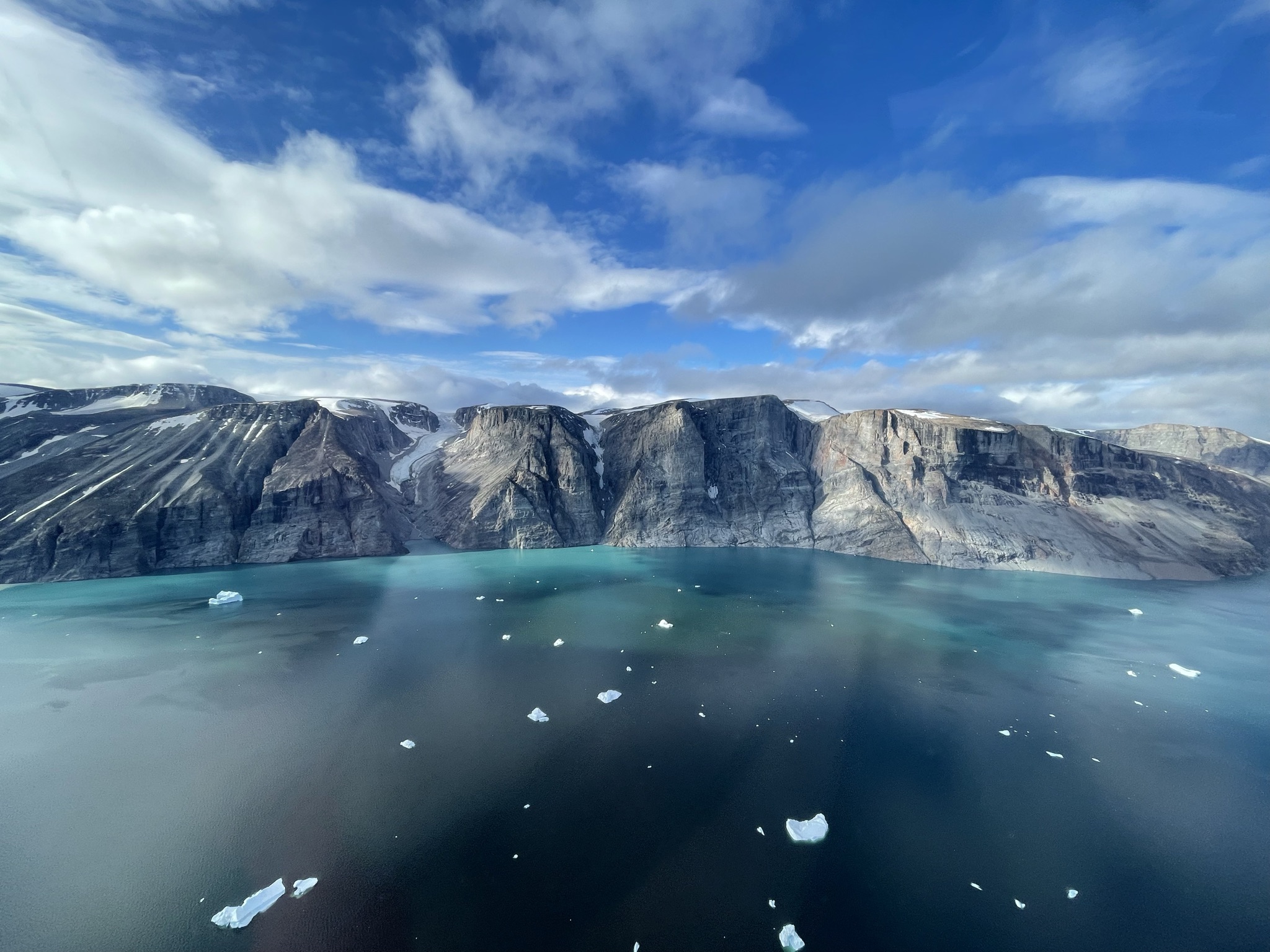
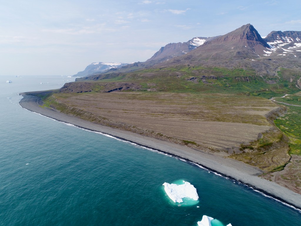
Coastal research in Greenland
From decades to millennia, we investigate key processes shaping Arctic coastal zones, including relative sea-level change, coastal cliff erosion, landslides, and tsunami impacts. These processes operate across a wide range of temporal and spatial scales and leave complex geomorphological and sedimentary signatures along Arctic coastlines.
Relative sea-level change research paper
Landslides and tsunami impact research paper
Coastal cliff erosion research paper

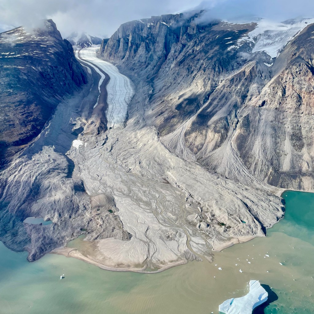
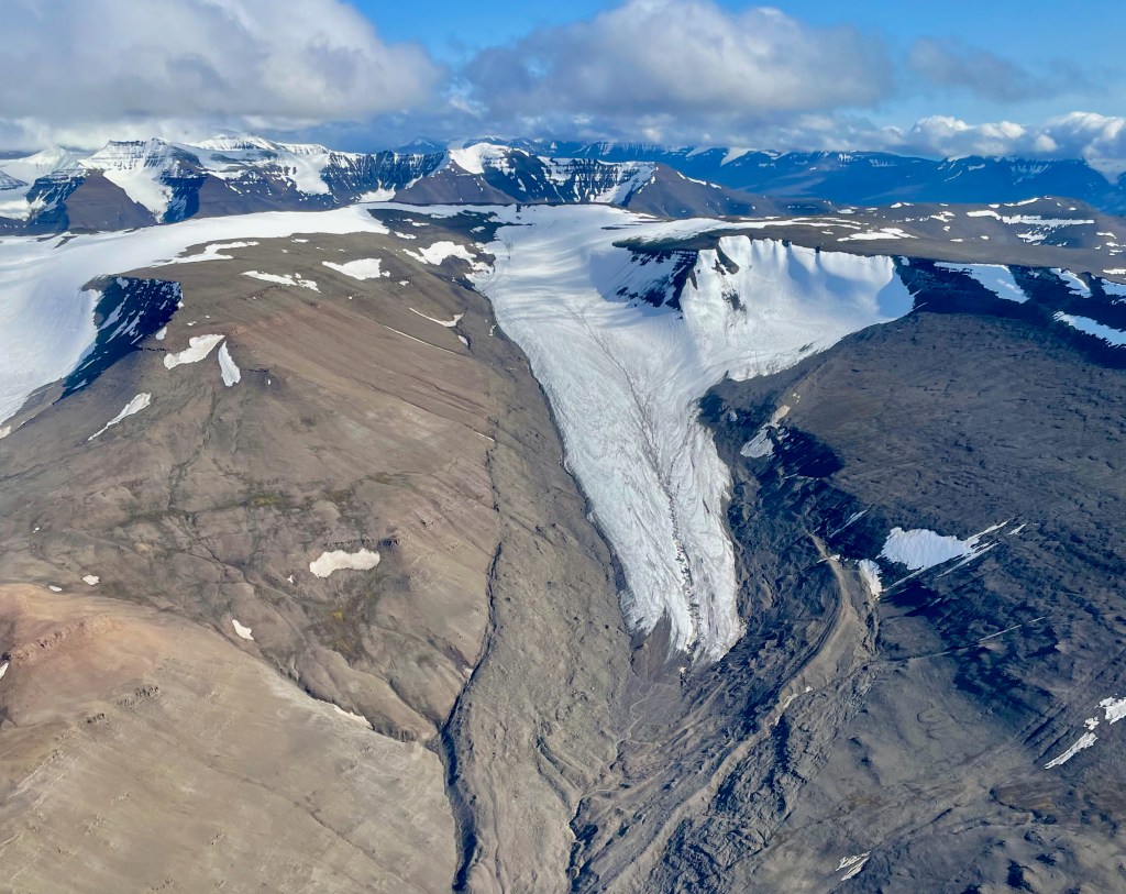
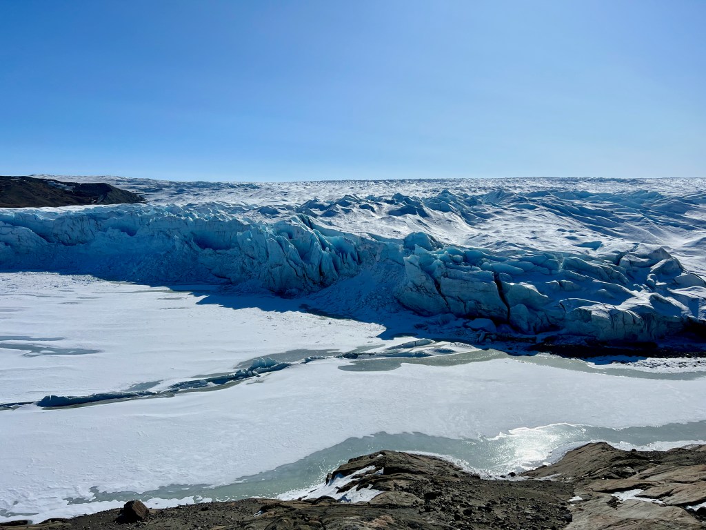
The Greenland Ice Sheet and its peripheral glaciers
We present the PROMICE-2022 Ice Mask, a high-resolution outline of the contiguous ice masses of the GrIS and the nunataks in its interior as of late August 2022. The dataset was derived from a true-colour Sentinel-2 mosaic at 10 m spatial resolution.
In another study, we document length fluctuations of >1,000 land-terminating peripheral glaciers in Greenland over more than a century. We find that their rate of retreat over the last two decades is double that of the twentieth century, indicating a ubiquitous transition into a new, accelerated state of downwasting.
iPhone LiDAR
We use the iPhone LiDAR to generate high-resolution indoor and outdoor 3D models, providing insights into object size, volume and geometry. The 3D models created by the LiDAR sensor can be used for precise measurement of changes over time

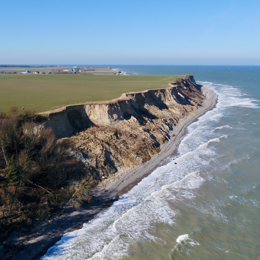
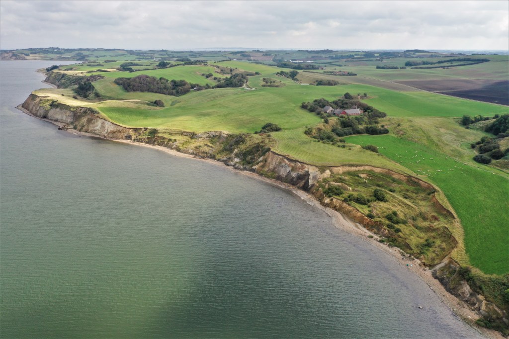
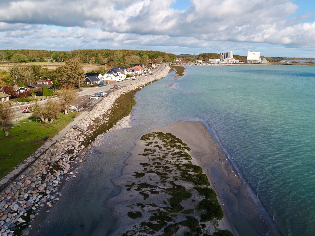
Coastal research in Denmark
We map coastal cliffs and landslides all across Denmark and couple cliff retreat rates to environmental driving factors.
Photo Gallery
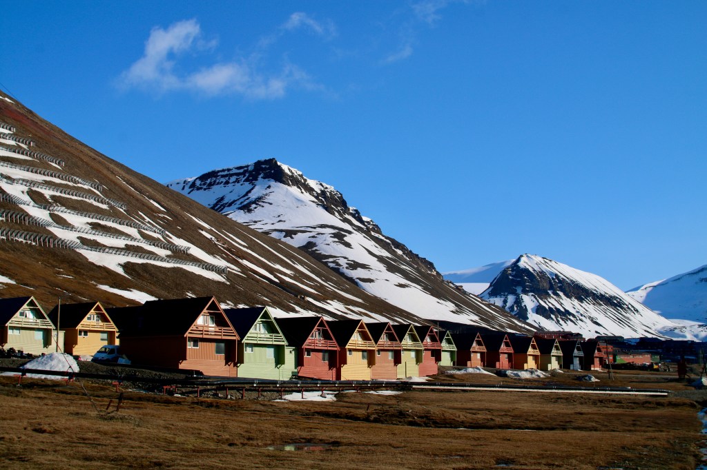
Kangerlussuaq 2023


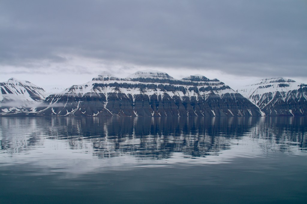
Svalbard 2023

Zackenberg 2022


Qeqertarsuaq 2022
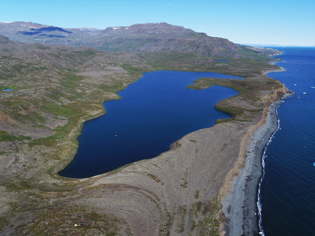


West Greenland 2021


Coastal Cliffs in Denmark